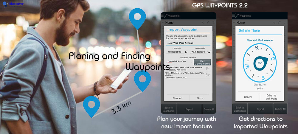
GPS Waypoints version 2.2 (September 2017) has better planning and finding activities, complementing core activities of mapping and surveying. This use case is specially useful for travellers and hikers. It was improved with the new feature Import waypoints and some fixes on Get me there.
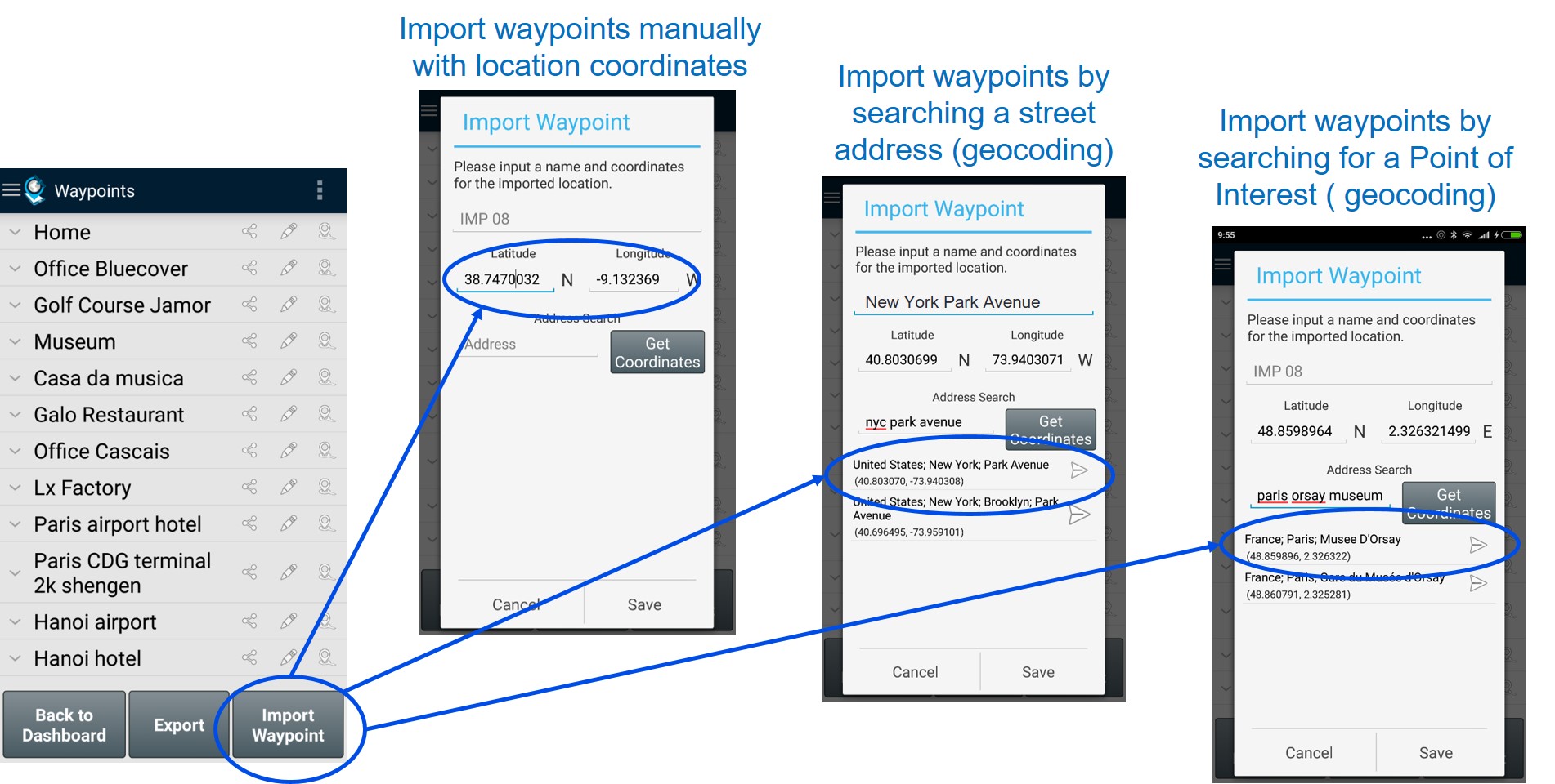
The Import Waypoints can be used to plan the places to visit or survey. The user can introduce manually the geographic coordinates (lat, long) of the place or alternatively search for a street address/point of interest that will be converted to coordinates (geocoding conversion).
During the visit/survey the Get Me There feature can be used to find the planned places, by getting directions and distances to the relevant waypoints. This feature was improved. The resuming of location services was fixed and the location services timeout can now be customised to allow users having the location services available for longer period after turning screen off.
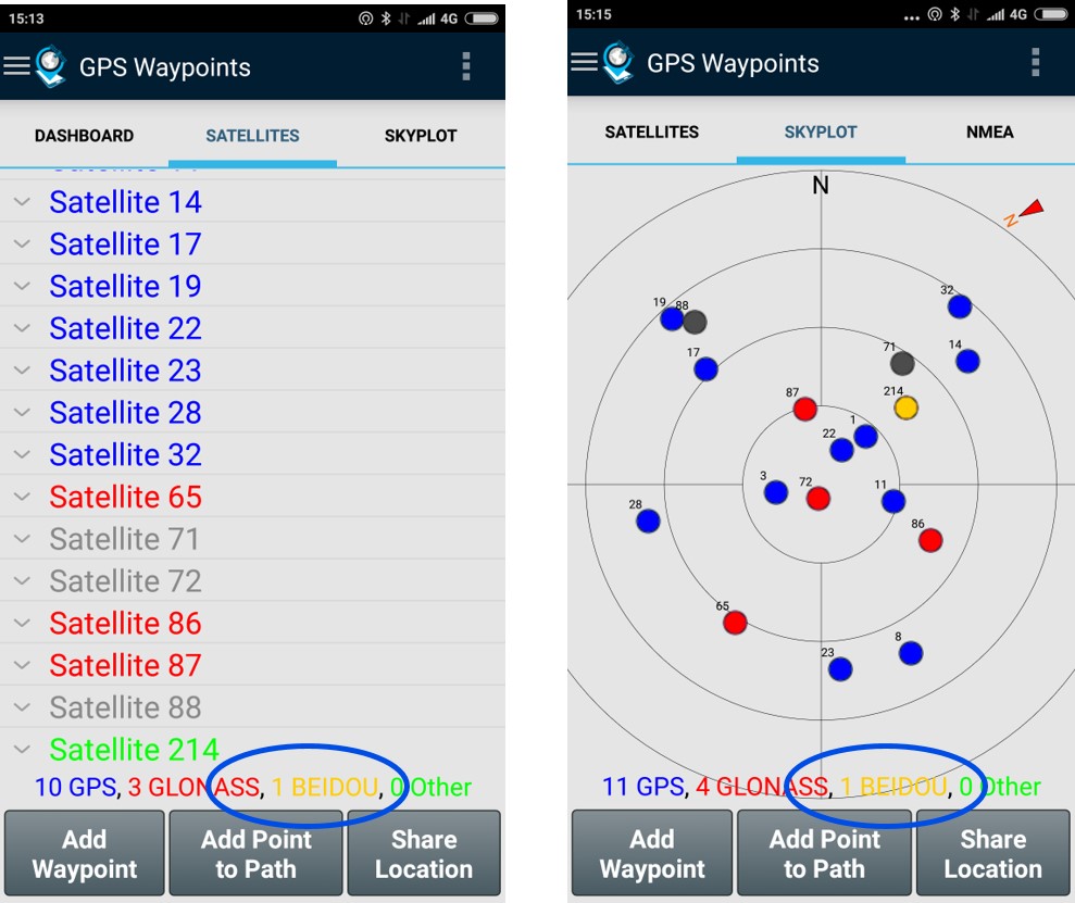
This version also enhances the skyplot view that was updated with chinese constellation Beidou, currently supported by many Chinese mobile manufactures.
Finally, this version is the first step towards a multi-language support as it now supports Portuguese language in addition to English.
Give it a try and send us your feedback.