
Bluecover made a study in 2017 aiming to provide up-to-date and accurate worldwide airports mapping information for a new online business travellers tool. This study, published in GISTAM 2018, assessed the possibility of using Sentinels program for improving airports’ mapping and monitoring changes, complementing the airport geographical information base obtained from OpenstreetMap (OSM). A few highlights of the results are described in the post.
The data availability of Sentinel-1 and Sentinel-2 at a global scale was verified using 9 airports from diferent regions, during the timeframe of 1st December 2016 to 31st January 2017.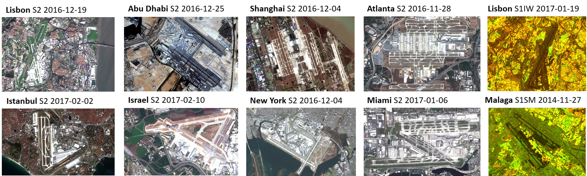
The Sentinel 2 data was available for all airports (except Munique where a dense cloud coverage was found during this period) while the spacial resolution was considered just on the limit, allowing to recognize airplanes. The Sentinel 1 data at IW High Resolution mode was also widely available for all airports but the spatial resolution of this mode was considered insuficient for most cases. The alternative Stripmode in full resolution has a very limited availability since it is used for on-request emergency events.
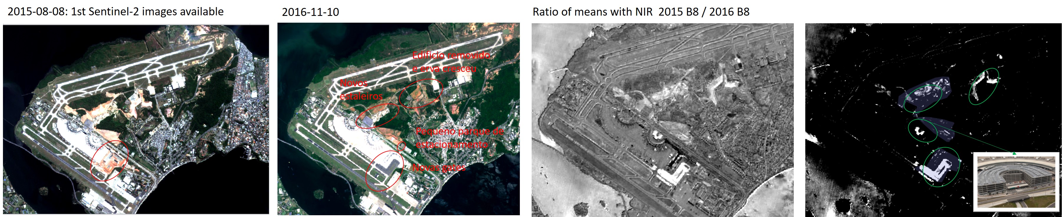
The S2 and OSM data mapping adequacy was verified in 3 locations, aiming to confirm the OSM data quality and Sentinel2 spatial and spectral resolution. The cases analysed identified diferent levels of S2 visibility and OSM data details.
The analysis results concluded that OSM does not offer a complete mapping solution since many airports have incomplete or outdated mapping data (e.g. not all airports have gates mapped). The data from open platforms needs also to be validated and improved.
The monitoring of airport changes were evaluated using multispectral change detection methods and interferometry processing techniques. The Sentinel-2 change detection chain using NIR/SWIR bands was considered feasible
The study concluded that the acquisition frequency of Sentinels is a great benefit to assure up-to-date information at a global scale. The mapping recommended approach for a target of 200 airports was to use OpenstreetMap base information, complemented with local data and assisted by Sentinels global data for temporal validation and improvements. The monitoring of changes approach shall integrate an extended EO change detection chain (Sentinel-2 change detection using NIR/SWIR bands) with the OSM change detection for checking changes at least every 3 months.
The Sentinel-2 change detection chain is desirable to be integrated in a self-contained package with API that would allow third parties to received mapping information and change detection notifications.
This work was performed by Bluecover and INESC-Coimbra to Waterdog. The full paper with the results was published in the proceedings of GISTAM 2018 – 4th International Conference on Geographical Information Systems Theory, Applications and Management. Bluecover made a oral presentation of the paper on 18th of March paper (see here the handouts of SCRAMJET EO mapping monitoring airports paper presentation).