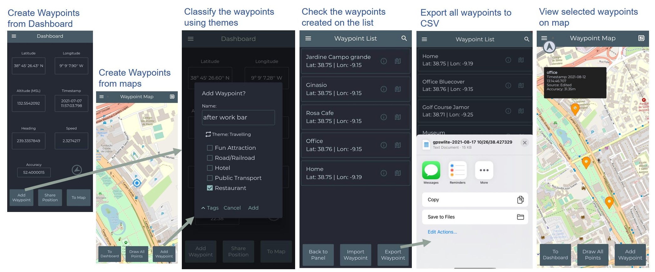
GPS Waypoints Lite is a versatile surveying application designed for iPhone users, serving both professional endeavors, such as those in earth sciences, agriculture and engineering, as well as personal pursuits like outdoor adventures and tourism. The main generic use cases, applied across diverse fields, are presented below.
a) Collecting, exporting and viewing Points: this base procedure collects points on the field and exports them to files in multiple formats.
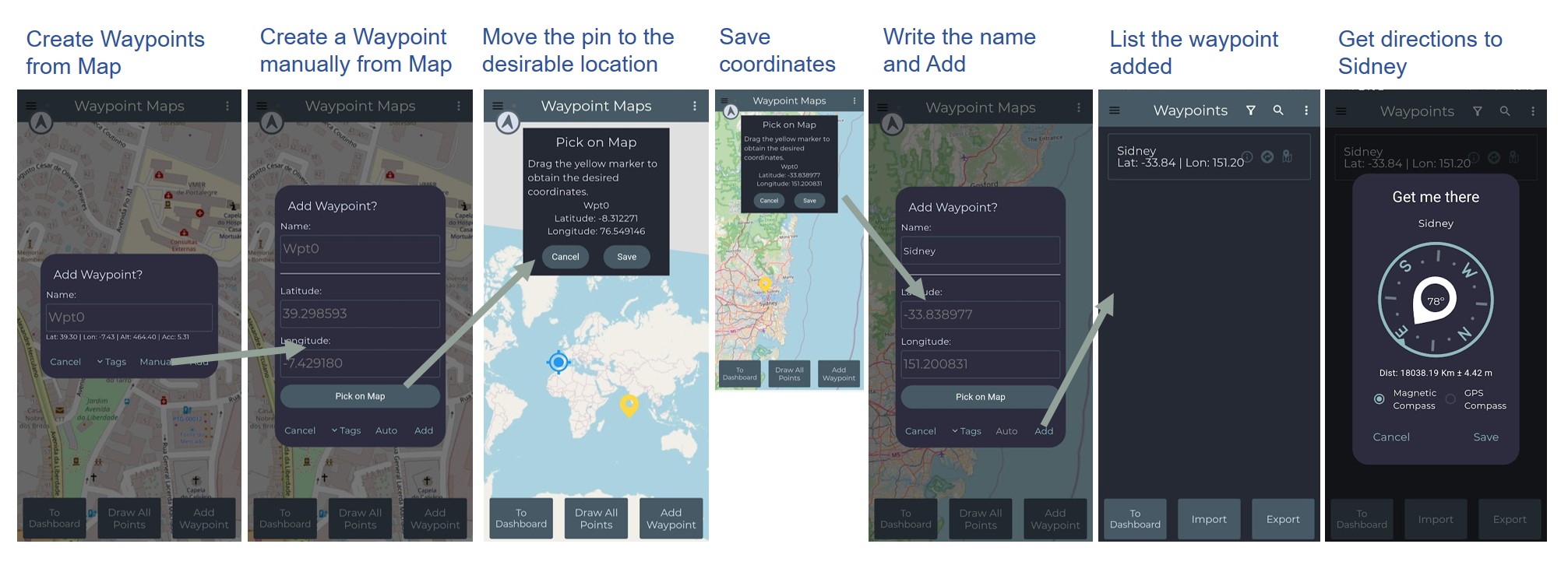
b) Creating Points Manually from Map to Get Directions: the points are created by picking a location on map and get directions to the new point added to database.
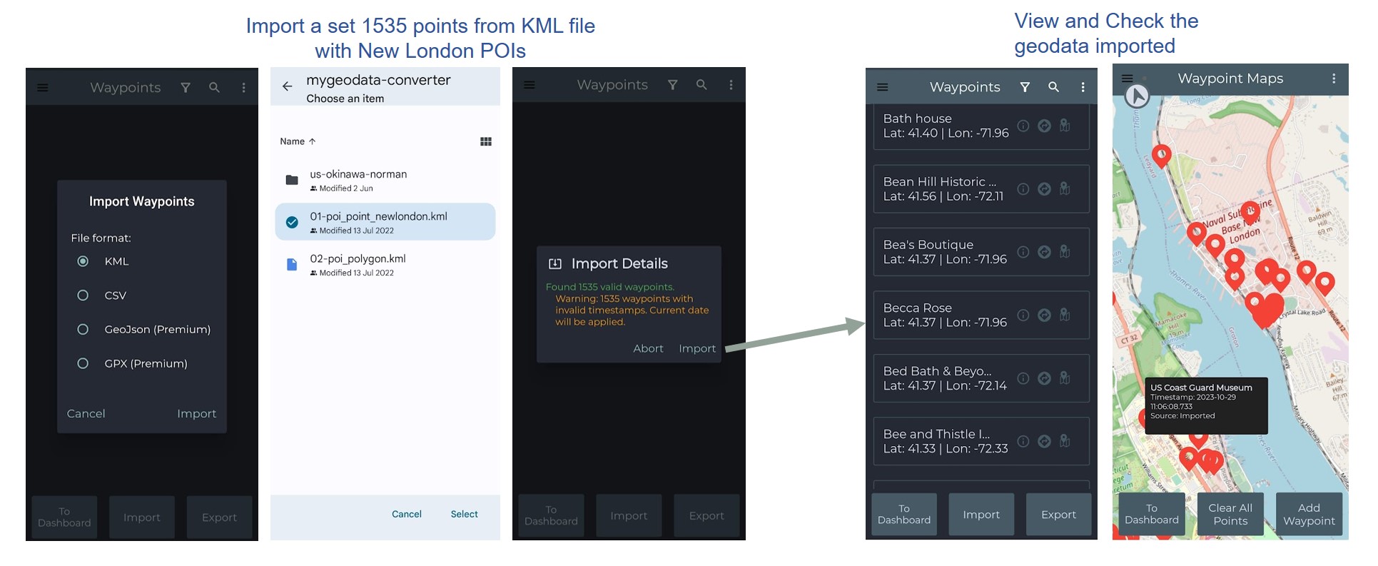
c) Import a set of points: another typical use case is to import data from a survey for exploring and checking it, such as importing New London Points-of-Interest.
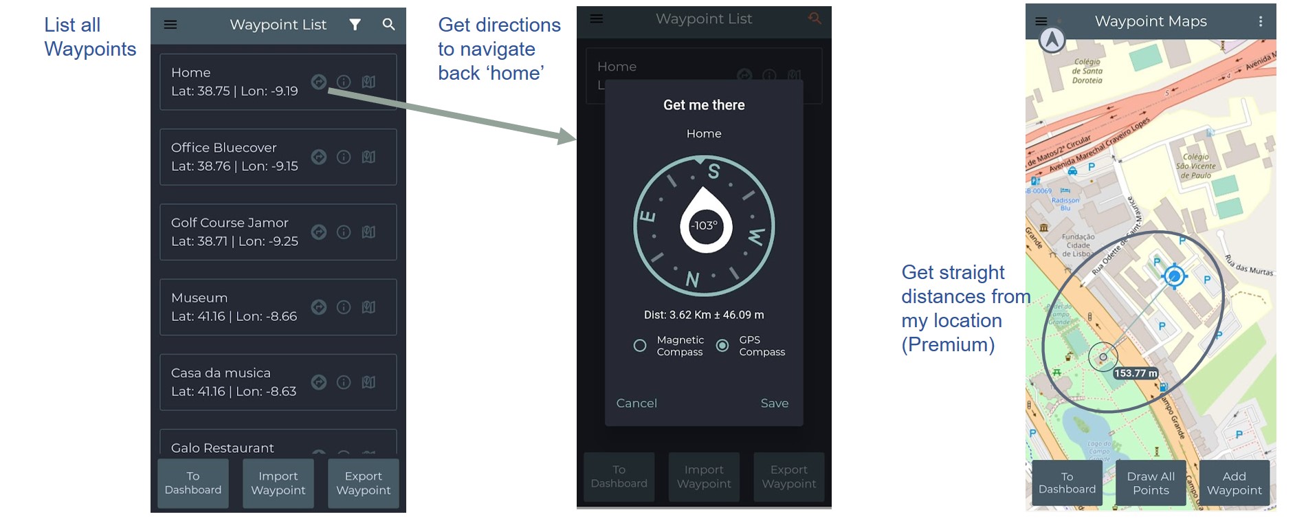
d) Find the way to a Point: it provides the base navigation for finding Points, such as getting direction to go back home. It also provides means to check straight distances from your current location.