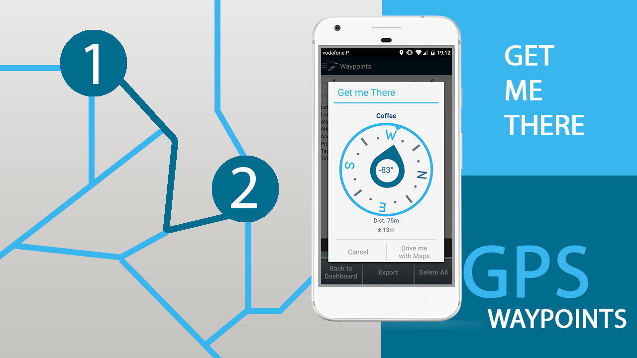
GPS Waypoints was enhanced with the GET ME THERE feature and other new personal and professional functionalities. The most recent update (version 2.1, Abril 2017) was based on the most requested features from users’ feedback.
The GET ME THERE allows to get directions from the current position to the collected Waypoints and Paths . The direction (in degrees) is presented over a compass to provide orientation to the user. It is complemented with the distance to the target point, including the uncertainty information related to this measurament. Note that for best experience, this function requires that the user’s handset comes equipped with a magnetic sensor (or “magnetometer” ).
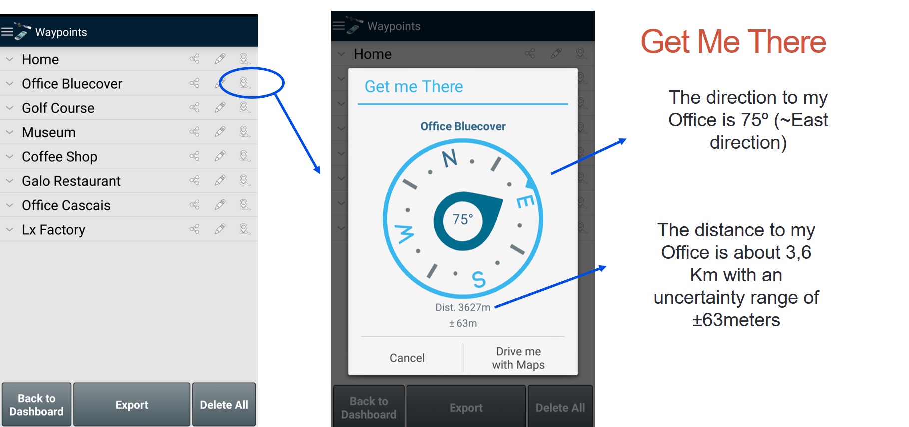
The GET ME THERE is a free feature and targets primarily outdoor and traveling activities, allowing the user to return back to a particular point without internet connection.
The IMPERIAL metrics support was also one of the main requests from users. It is a free feature (soon available) to convert for altitude, accuracy, distance, areas and speed measurements into feets, square feets and feets per second.
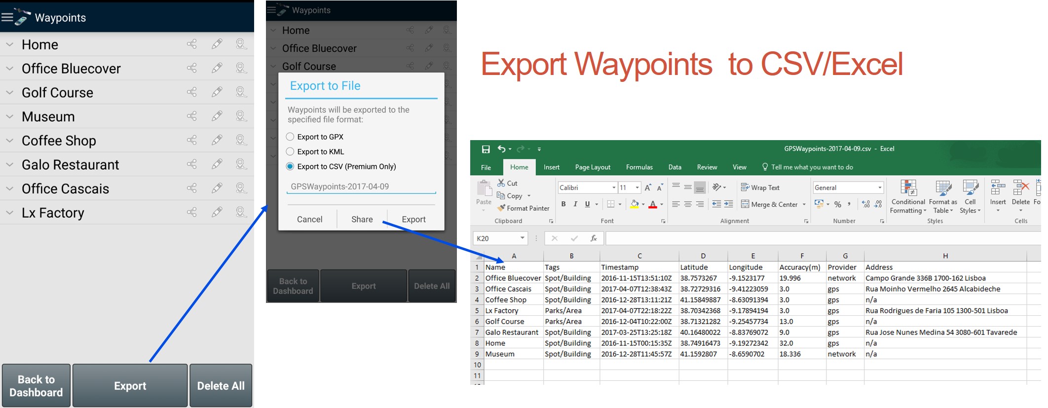
The EXPORT data to CSV is a new export format of Waypoints and Paths. It is released as a professional feature available only on Premium subscription.
For updated information follow our hashtag #GPSwaypoints in twitter and tryout our new features that were prepared to enhance your experience.
Download GPS Waypoints here
![]()