GISUY is a multi-constellation receiver, developed by Bluecover, featuring a Global Navigation Satellite System (GNSS) chipset, capable of processing the positioning of multiple satellite systems accessible via USB and Bluetooth interfaces. The receiver is being tested since 2017 with various chipsets in different regions. Although the results highly depend on the testing environment, the best chipset performances were achieved with Telit GNSS products. This chipset was recently tested with EGNOS and Galileo configurations, with the purpose to constitute viable redundant solution to monitor GNSS signals at airports. The tests of these two setup configurations were compared with the Standard Positioning Service (SPS) configuration (using GPS and GLONASS constellations) and also between each other. All tests were performed in similar conditions, namely by making acquisitions in open sky during fixed periods of 10 minutes and using the same active ceramic antenna (in some of cases sharing the same antenna). The results of the tests and conclusions are presented hereafter .
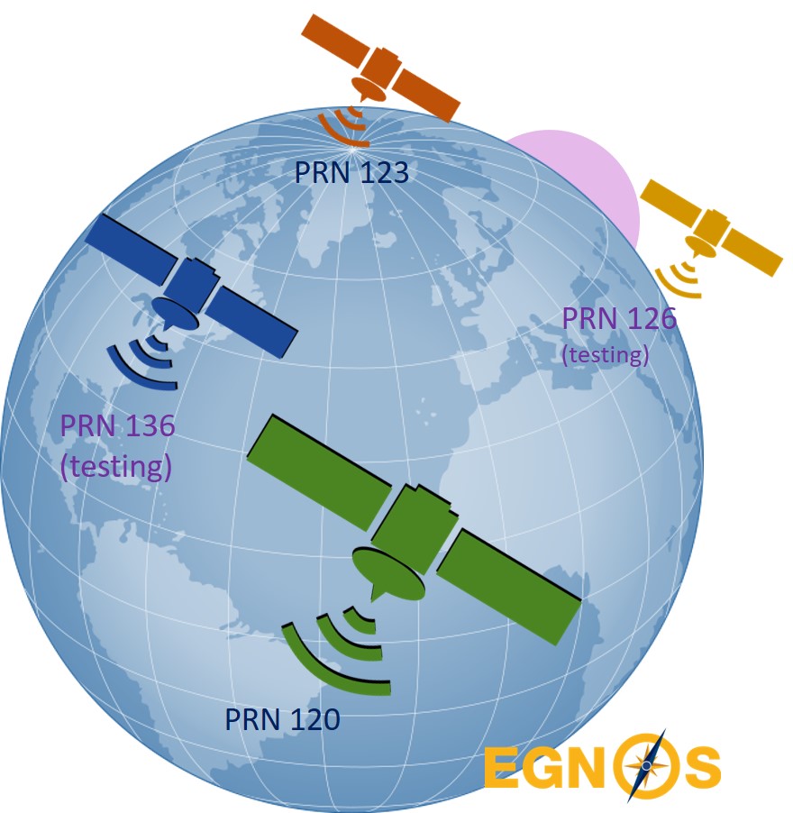
EGNOSEGNOS is the European Satellite based Augmentation System (SBAS) that supplements the GPS, GLONASS and Galileo constellations by reporting on the reliability and accuracy of their positioning data and sending out corrections. The system is composed by a network of ground stations and geostationary satellites, capable of providing corrections to achieve a horizontal position accuracy better than 7 metres. One main use of the system is in aviation. The system started operations in July 2005 and by the time this assessment was performed, there were the following 4 satellites in operations:
|
 |
|||||||||||||||||||||||||||||||||||||||||||||
The 4 tests performed with a SBAS configuration, using both active and testing EGNOS satellites, were fully successful as presented in the table:
The following findings were achieved:
|
||||||||||||||||||||||||||||||||||||||||||||||
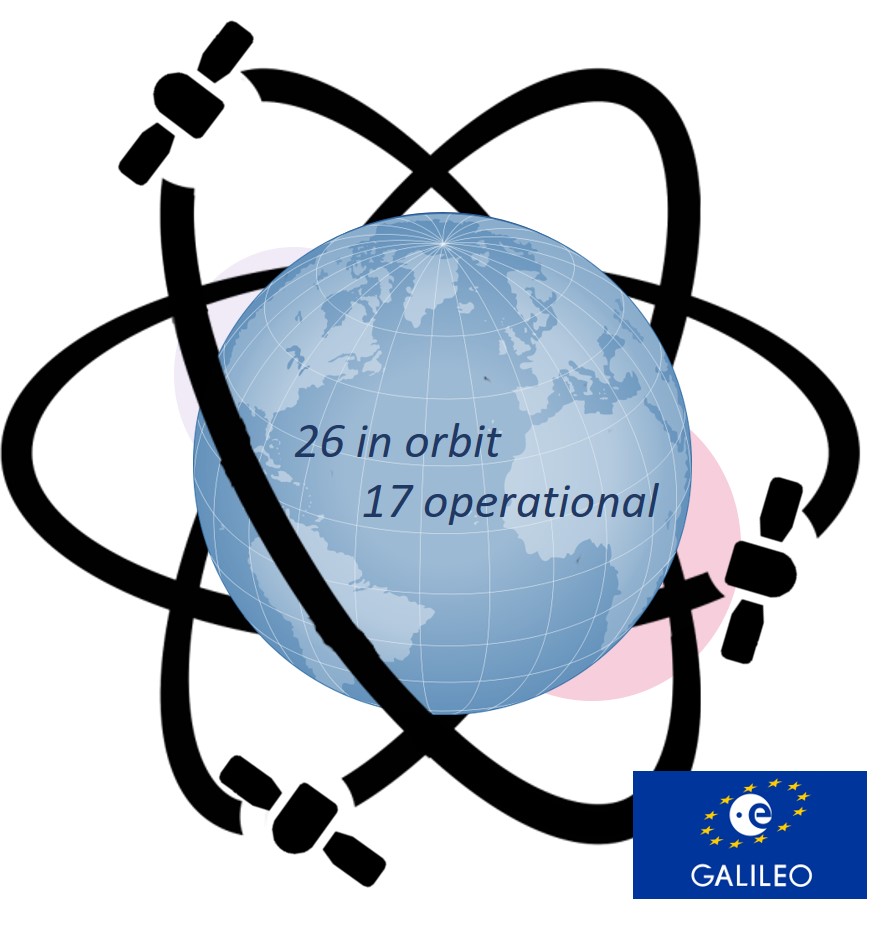
GalileoGalileo is the European GNSS, developed by the European Union, aiming to provide an independent high-precision positioning system from GPS, GLONASS and BeiDou systems. The use of basic Galileo services is free and open to everyone, while higher-precision capabilities will be available for paying users. Galileo is intended to provide horizontal and vertical position measurements within 1-metre precision, and better positioning services at higher latitudes. Galileo started offering Early Operational Capability (EOC) on December 2016, providing initial services with a weak signal. In July 2018, just before our GISUY tests, 4 new satellites were launched achieving a total of 26 satellites in space (including 17 in operations):
The complete 30-satellite Galileo system (24 operational and 6 active spares) is expected by 2020. |
 |
|||||||||||||||||||||||||||||||||||||||||||||
The 4 tests performed with this configuration demonstrated that GALILEO has already a good coverage, as presented in the table below:
The following findings were achieved:
|
||||||||||||||||||||||||||||||||||||||||||||||
Conclusion
The testing performed with GISUY in Portugal with the configurations SPS GPS-GLONASS, EGNOS and SPS GPS-GALILEO achieved similar accuracies at open sky, with average horizontal deviations always below 2 m.
| GISUY v3 configurations | Recordings | Avg Used Satellites | Min horizontal deviation (m) | Avg horizontal deviation (m) | Max horizontal deviation (m) |
| SPS GPS-GLONASS | 6 | 16.78 | 0.78 | 1.08 | 1.32 |
| SBAS EGNOS (testing mode) | 4 | 15.22 | 0.32 | 1.06 | 1.30 |
| SPS GALILEO-GPS | 4 | 13.35 | 0.93 | 1.56 | 3.24 |
The SBAS EGNOS has in average a better accuracy than Standard Positioning Service (Non-SBAS), and the SPS GPS-GLONASS is currently better than SPS GPS-GALILEO but the system may evolve.
As a conclusion, the GISUY configuration for monitoring GNSS signals (refer to SWAIR project) can use any of the these three configurations. The SBAS EGNOS shall be the default one in airports supporting GNSS vertical guidance (LPV) approaches, while SPS GPS-GLONASS on other airports with GNSS-based approaches. The SPS GPS-GALILEO is promising configuration for future evolution.
When using GISUY for surveying purposes, the Standard Positioning Service (SPS) and SBAS configuration are the most promising configurations. The SPS GPS-GLONASS may capture more signals in urban areas and dense forest and thus can be the default configuration while in open sky SBAS could be more performer.
Acknowledgements: these tests and activities was performed by Bluecover with the support of SWAIR project in collaboration with Present Technologies and CITEUC.
