A poster from Costline Watch is being presented at SPIE .Remote Sensing 2014, with the title: "Detecting changes on coastal primary sand dunes using multi-temporal Landsat Imagery". It is the second publication supporting the development of Coastline Watch concept, this time at "Image and Signal Processing for Remote Sensing Conference" held on 22 – 24 September 2014 at Amsterdam.
This poster supports the shoreline definition and primary sand dunes change detection and shows that an effective monitoring system can be easily implemented using open data and tools (QGIS and Orfeo toolbox). It uses different methods and techniques giving particular attention on:
- Panshaperning of multispectral images to meet the 15 meters spatial resolution
- Kmeans clustering method for unsupervised classification to extract shoreline and primary sand dunes.
- Penalized least square method to vectorize and smooth of each raster shoreline
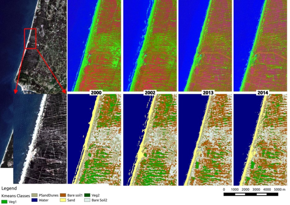
The analysis of the extracted shorelines for the years 2000, 2002, 2013, and 2014 identified areas of erosion (Area 1) and acression (Area 2).

The extraction of Primary Sand Dunes were obtained from the 4 generated synthetic images (upper 4 images) using kmeans classification (lower 4 images).
This work follows a close collaboration between Prof. Gil Goncalves (Univ. Coimbra) and Nuno Duro (Bluecover) towards the development and commercialization of CoastLine Watch.